

Blogs
Our community blogs
-
High Altitude Diaries
A blog by high_altitude_guy in Aerial Photography- 1 Entry
- 0 Comments
- 302 Views
Personal drone flying experiences, equipment reviews, aerial photography projects, safety notes, and drone-related adventures.I've been lurking on this site for a while and finally decided to start posting because I feel like this is something that doesn't get talked about enough for newer pilots - not the sexy stuff like camera settings or flight modes, but just the boring, unglamorous habit of actually running a pre-flight checklist before every single flight. I fly a DJI Mini 3 Pro mostly, with some occasional time on a friend's Mavic 3, and everything I'm going to talk about applies pretty broadly to most consumer drones.
Why I finally started taking this seriously
About four months ago I was out at a local park, conditions were perfect, golden hour was coming up fast, and I was rushing to get in the air. I launched, got maybe 80 feet up, started my shot - and then I noticed the gimbal was doing this weird stuttering thing. I brought it back down and realized I'd left the gimbal guard on. Just sitting right there on the camera the whole time. The footage was garbage and I wasted the best light of the day dealing with it. Embarrassing, and honestly that was a mild outcome. I've heard of people launching with ND filters on from a previous session that weren't appropriate for the lighting conditions, or worse, with props that weren't fully locked.
That was my wake-up call. I went home and actually wrote out a checklist. Took me maybe 20 minutes. And now I use it every single flight without exception.
What my checklist actually looks like
I broke mine into three sections: before I leave the house, when I arrive at the location, and right before takeoff. I'll walk through each one.
Before leaving the house: This is where I catch the stuff that ruins your whole day. I check that both the drone battery and the controller battery are fully charged. I also check my phone charge because the DJI Fly app drains it fast. I make sure the SD card is in the drone, because I cannot tell you how many times I've seen people post about flying an entire session and recording nothing. I check that I've got my prop guards or spare props in the bag if I'm going somewhere tight. And if I'm flying somewhere new I at least do a quick check on airspace using or the DJI Fly map to confirm I'm not rolling into controlled airspace without knowing it.
At the location: First I actually look at the sky and my surroundings. Wind, cloud cover, any birds in the area. I scope out where I'm going to stand, where my landing zone is, and whether there are any obstacles I need to be aware of - power lines are the big one, they don't always show up obviously until you're walking the area. I also make sure there's nobody nearby who's going to be a problem, like kids running around right where I'm planning to land.
Right before takeoff: This is the detailed mechanical stuff. Props on and locked - I physically spin each one and make sure it's seated. Gimbal guard off (learned that one). Camera lens clean, no smudges or condensation. Battery fully clicked in and secure. I power on the controller first, then the drone, wait for the connection to establish. I check the DJI Fly app for any warnings - firmware updates pending, compass calibration needed, that kind of thing. I do a quick compass calibration if I'm in a new location or if the app is nagging me about it. Return to Home altitude is set appropriately for the area, which matters a lot if you're somewhere with trees or buildings. And I do a very short hover at about 3 feet for maybe 15 seconds before I actually fly anywhere, just listening to the motors and watching the drone's behavior. Any weird vibration or drift and I'm bringing it down to check before going further.
Some things I added over time
The first version of my checklist was pretty basic. I've added a few things since then based on things I've learned or mistakes I've almost made.
One is checking my obstacle avoidance settings intentionally. I used to just leave it on whatever it was from last session. But if you've been flying in a tight space with sensors set to brake instead of bypass, and then you go out to an open field and want to fly fast and low, those settings matter. Now I confirm them explicitly before every flight.
I also added a reminder to check the "max altitude" setting in the app. It defaults to 120 meters (roughly 400 feet, which lines up with the FAA recreational limit for most uncontrolled airspace), but if I'm flying in an area with a different authorized ceiling I need to adjust that. Worth a 5-second check.
Battery temperature is another one. In cold weather, especially below about 50?F, lithium batteries don't perform the same way. I've started hovering close to the ground for a couple minutes in cold conditions to warm the battery before climbing. The DJI app actually shows battery temp and will warn you if it's low. Don't ignore that warning.
How to actually build your own
I typed mine out in Google Keep so it's always on my phone. I've seen people print laminated cards which is kind of overkill in my opinion but hey if that works for you go for it. The format doesn't matter. What matters is that you actually use it consistently and update it when you learn something new.
If you're just starting out and don't know where to begin, check the manual for your specific drone first - DJI and most other manufacturers include recommended pre-flight steps. Use those as a baseline and then add things based on your own experience and flying environment.
The whole checklist takes me maybe 3 to 5 minutes to run through. That's nothing compared to a ruined flight or a crash. And honestly once you do it enough it becomes automatic - you're not even really thinking about it, you're just doing it, which is kind of the point.
Anyway that's my first real post on here. If anyone has stuff on their own checklists that I haven't mentioned I'd genuinely love to hear it in the comments. I'm still figuring stuff out like everyone else.
-
Up In The Air With Mike
A blog by Mike Thompson in FPV Drones- 1 Entry
- 0 Comments
- 386 Views
Personal drone flying experiences, equipment reviews, aerial photography projects, safety notes, and drone-related adventures.Pretty hard, it turns out. But also really fun, and I feel like I learned more in those two sessions than I had in the previous six months combined. So I wanted to write this up while it's still fresh because maybe it'll save somebody else some of the same headaches.
The Location and Planning Part
I drove out to a reservoir about 45 minutes from my house. There's a spot where you can park and walk down to a flat area near the water with some hills behind it. I'd actually scouted it on foot a few weeks before, which I'm really glad I did because it meant I knew roughly where I wanted to position myself and what direction the light would be coming from. I used the app PhotoPills to check where the sun was going to set and when golden hour would actually start. If you haven't used that app, seriously look into it. It's not free but it's worth it.
I got there about an hour and a half before sunset, which gave me time to set up and also just fly around and get a feel for the area. Wind was maybe 8 mph out of the northwest, pretty manageable. No other people around, which meant I wasn't stressing about flying over anyone.
Camera Settings - Where I Went Wrong First
Okay so this is where I made my first dumb mistake. I had the Mini 3 Pro set to auto exposure because that's just how I'd been flying. I took maybe 20 shots and when I pulled them up later on my laptop they were all over the place - some blown out, some weirdly dark, and none of them had that warm punchy look I was going for. Auto is fine when you're just flying around but for serious photography you really need to take control.
I went back out four days later and this time I switched to manual mode and shot in RAW. For the settings I ended up at ISO 100, f/2.8 (the Mini 3 Pro doesn't give you a ton of aperture options but f/2.8 is the widest), and then I adjusted shutter speed to get the exposure right - ended up around 1/200 for most shots during golden hour. I also turned on the histogram overlay so I could actually see if I was clipping the highlights. That made a huge difference.
One thing I read before going out was about the 180-degree shutter rule for video, but for stills I was more focused on just keeping ISO low and not blowing out that sky. The sky during golden hour is doing all kinds of crazy stuff and if you let it blow out you've basically lost the shot.
I Also Tried an ND Filter for the First Time
I picked up a cheap set of ND filters off Amazon - I think it was like a 4-pack with ND4, ND8, ND16, and ND64. I used the ND16 for most of the shoot. Honestly I'm not totally sure I needed it for stills in the way you need them for video, but I do think it helped me slow down the shutter a little and get a slightly smoother look on the water. The reservoir had some gentle ripples and with a slightly slower shutter you could see just a little bit of silkiness to it. Nothing dramatic but I liked it.
Putting on the filter was kind of nerve-wracking the first time because I was standing there trying to snap this little piece of glass onto my drone and I was terrified of dropping it or scratching the lens. It wasn't hard though, just a little fiddly.
Composition Stuff I Was Thinking About
I'm not a trained photographer or anything so I've just been reading and watching a lot of stuff online about composition. The main things I tried to do were use the rule of thirds (put the horizon on the upper third so you're showing more water and foreground), look for leading lines, and try different altitudes. I think the altitude thing is something people don't experiment with enough. I see a lot of drone shots that are all taken from like 200-300 feet and they all start to look the same. I tried some shots from maybe 80 feet and some from up around 350 feet and they feel totally different.
The lower shots felt more intimate I guess - you could see the texture of the water surface and the rocks along the edge. The higher shots gave you more of that sweeping landscape feel with the hills in the background. Both were useful, just for different things.
I also spent some time just flying laterally and tilting the gimbal at different angles instead of just pointing it straight down or straight forward. Some of my favorite shots from the session were with the gimbal at maybe 45 degrees tilted down while I was slowly moving sideways. Kind of an awkward angle to think about but it gave an interesting perspective on the shoreline.
Editing in Lightroom
I use Lightroom Classic and this is where the RAW files really paid off. The JPEGs I had from my first session were pretty locked in - not much you could do with them. The RAW files from session two I was able to really work with. I pulled the highlights down hard on the sky, brought up the shadows in the foreground, added some warmth and a little bit of dehaze. Nothing crazy, I'm not trying to make it look fake.
The colors during golden hour were already doing most of the work honestly. I just tried to make sure the edit matched what I remembered seeing when I was standing there.
What I'd Do Differently
A few things. I'd bring a jacket - I was out there until after sunset and it got cold fast. I'd also bring a second battery because I used almost all of battery one just messing around during my first practice pass and then had to rush through the actual golden hour window. Also I'd get there even earlier and do a full test flight first so I'm not figuring out my camera settings when the light is already going.
But overall I'm really happy with how session two went. I got maybe five or six shots I'm genuinely proud of, which doesn't sound like a lot but for me at this point it felt like a big deal. I'm planning to head back out to the same spot in a few weeks and try it in different conditions - maybe some cloud cover which I've heard can actually look amazing for this kind of shot.
If you're also kind of new to aerial photography and haven't tried golden hour yet, I'd really recommend just going for it. Even if your first attempt goes like mine did - kind of sideways - you'll learn a ton.
-
SkyPilot's Blog
A blog by SkyPilot in Beginner Drone Pilots- 3 Entries
- 0 Comments
- 1318 Views
A personal beginner drone journey sharing first flights, mistakes, lessons learned, and what I wish I knew before becoming a drone pilot to help new flyers start right.
```htmlDrone interference represents one of the most critical challenges facing both recreational FPV pilots and commercial operators in today's increasingly congested electromagnetic spectrum. As the skies fill with more unmanned aircraft systems and our environment becomes saturated with wireless devices, understanding and managing drone interference has become essential for safe, legal, and successful flight operations.
Signal interference can transform a routine flight into a dangerous situation within seconds, potentially causing crashes, flyaways, or worse?collisions with manned aircraft. This comprehensive guide explores the technical aspects of drone signal loss, regulatory requirements, and proven strategies for maintaining reliable communication links in challenging RF environments.
What Is Drone Interference and Why It Matters
Definition of Drone Signal Interference
Drone interference occurs when unwanted electromagnetic signals disrupt the communication between a drone and its operator, affecting either the control link, video transmission, or GPS reception. This drone interference can manifest as degraded signal quality, complete signal loss, or erratic behavior in flight control systems.
The phenomenon encompasses several types of signal disruption:
- Control link interference affecting flight commands
- Video transmission degradation impacting FPV operations
- GPS signal jamming disrupting navigation systems
- Telemetry data corruption affecting flight parameters
Types of Interference: Signal Loss vs Signal Disruption
Understanding the distinction between complete drone signal loss and partial signal disruption is crucial for proper response protocols. Signal loss represents a complete communication breakdown, while signal disruption involves degraded performance that may still allow limited control.
Complete signal loss typically triggers fail-safe modes such as return-to-home (RTH) or controlled landing sequences. Signal disruption, however, may cause erratic behavior, reduced range, or intermittent control responses that can be equally dangerous if not properly managed.
Safety Risks and Potential Consequences
The safety implications of drone interference extend far beyond equipment damage. Uncontrolled aircraft pose risks to people, property, and other aircraft. In congested airspace, interference-induced flight path deviations can create collision hazards with manned aviation.
Common consequences include:
- Loss of situational awareness for the pilot
- Uncontrolled descent or flyaway events
- Collisions with obstacles or other aircraft
- Emergency landing in populated areas
- Regulatory violations and potential enforcement action
Legal Implications Under FAA Regulations
The Federal Aviation Administration takes drone interference seriously, particularly when it affects aviation safety or violates controlled airspace. Operators must understand their legal obligations regarding interference prevention and reporting requirements under current regulations.
FAA drone interference rules require pilots to maintain positive control of their aircraft at all times and operate in a manner that does not interfere with other aircraft operations. Violations can result in civil penalties, certificate actions, or criminal charges in severe cases.
Common Causes of Drone Signal Interference
Radio Frequency Congestion (2.4GHz and 5.8GHz Bands)
The most prevalent source of drone frequency issues stems from overcrowded ISM bands used by consumer electronics. The 2.4GHz band, shared with Wi-Fi, Bluetooth, and microwave ovens, experiences significant congestion in urban environments.
2.4GHz interference commonly affects control links, while 5.8GHz drone problems typically impact FPV video transmission. Both frequencies suffer from increasing congestion as more devices compete for limited spectrum space.
Key sources of RF interference include:
- Wi-Fi routers and access points
- Bluetooth devices and wireless peripherals
- Other drone operations in the vicinity
- Industrial, scientific, and medical equipment
- Cellular network infrastructure
Electromagnetic Interference from Power Lines and Electronics
Electromagnetic interference drones encounter near power infrastructure represents a significant operational hazard. High-voltage transmission lines generate powerful electromagnetic fields that can overwhelm sensitive receiver circuits and cause erratic flight behavior.
Electrical substations, transmission towers, and industrial facilities create complex electromagnetic environments that can disrupt multiple frequency bands simultaneously. This RF interference drones experience near power infrastructure often requires significant separation distances for safe operation.
Physical Obstacles: Buildings, Terrain, and Weather Conditions
Physical barriers contribute to signal degradation through reflection, absorption, and multipath effects. Dense urban environments create challenging conditions for maintaining reliable communication links, particularly for low-power FPV systems.
Terrain features, vegetation, and atmospheric conditions all influence signal propagation characteristics. Understanding these environmental factors helps operators predict potential interference issues and plan flight paths accordingly.
GPS Jamming and Disruption
GPS interference drones face can originate from intentional jamming devices or unintentional electronic emissions. GPS disruption affects critical navigation functions, including position holding, waypoint navigation, and return-to-home operations.
Military facilities, airports, and certain industrial operations may generate GPS interference as part of their normal operations. Pilots must be prepared for GPS-denied environments and understand backup navigation procedures.
Device Conflicts: Wi-Fi, Smartphones, and Other Drones
Modern flight environments often involve multiple electronic devices operating simultaneously. Smartphones, tablets, laptops, and other drones can create complex interference patterns that affect flight operations.
Multi-pilot operations require careful frequency coordination to prevent mutual interference. Even seemingly unrelated devices can create problems if they operate on conflicting frequencies or generate spurious emissions.
Environmental Factors Affecting Drone Signals
Urban vs Rural Flying Environments
The electromagnetic environment varies dramatically between urban and rural locations. Cities present dense RF congestion from multiple sources, while rural areas may offer cleaner spectrum but present other challenges such as terrain masking and distance limitations.
Urban drone interference typically involves multiple simultaneous sources requiring sophisticated mitigation strategies. Rural operations may encounter different challenges, including atmospheric effects and terrain masking that can cause unexpected signal loss.
Weather Conditions and Atmospheric Interference
Atmospheric conditions significantly influence radio wave propagation, particularly at higher frequencies used for FPV video transmission. Humidity, precipitation, and temperature inversions can create signal fading or enhancement effects that impact flight operations.
Precipitation static, temperature gradients, and atmospheric ducting can cause unpredictable signal behavior. Professional operators must consider meteorological factors when planning operations in challenging environments.
High-Voltage Power Lines and Electromagnetic Fields
Power transmission infrastructure creates intense electromagnetic fields that can overwhelm drone electronics. Corona discharge from high-voltage lines generates broadband interference across multiple frequency bands.
Safe separation distances from power lines serve dual purposes: preventing physical collision and avoiding electromagnetic interference. The required separation distance increases with voltage levels and atmospheric conditions.
Metal Structures and Signal Reflection/Absorption
Large metal structures create complex RF environments through reflection and absorption effects. These structures can cause signal shadowing, multipath propagation, and frequency-selective fading that affects different systems differently.
Buildings, bridges, towers, and industrial structures all present unique challenges for maintaining reliable communication links. Understanding these effects helps operators plan appropriate flight paths and operating procedures.
FPV Drone Signal Loss and Interference Solutions
Frequency Band Selection (2.4GHz vs 5.8GHz)
FPV interference management begins with proper frequency selection based on operational requirements and environmental conditions. Each frequency band offers distinct advantages and limitations that must be considered during system planning.
The 2.4GHz band provides better obstacle penetration and longer range but suffers from higher congestion levels. The 5.8GHz band offers more available channels and less congestion but has reduced range and obstacle penetration capabilities.
Key considerations for frequency selection include:
- Local spectrum congestion levels
- Required operating range and obstacle penetration
- Available channel options and coordination requirements
- Equipment compatibility and performance characteristics
Channel Management and Avoiding Overlap
Proper channel management prevents mutual interference between multiple drone operations. Understanding channel spacing requirements and potential overlap issues helps maintain clean communication links in multi-aircraft environments.
Channel coordination becomes critical during group flights or operations near other drone activities. Establishing clear communication protocols and frequency management procedures prevents interference-related accidents.
Antenna Positioning and Quality Considerations
Antenna selection and positioning significantly impact signal quality and interference susceptibility. High-quality antennas with appropriate gain patterns and polarization characteristics improve signal-to-noise ratios and reduce interference susceptibility.
Proper antenna installation includes consideration of mounting location, orientation, and protection from physical damage. Circular polarization often provides better performance in multipath environments common in urban operations.
VTX Signal Optimization Techniques
VTX signal problems can often be resolved through proper transmitter configuration and optimization. Power level adjustment, channel selection, and antenna matching all contribute to reliable video transmission performance.
Video transmitter optimization involves balancing transmission power, heat generation, and interference potential. Higher power levels may overcome some interference but can create problems for nearby operations.
FAA Regulations and Interference Reporting
Current FAA Rules on Interference and Aviation Safety
The FAA's approach to drone interference focuses on maintaining aviation safety while enabling legitimate drone operations. Current regulations require operators to maintain positive aircraft control and avoid interference with manned aviation.
FAA drone interference rules encompass several key areas:
- Positive control requirements throughout flight operations
- Immediate notification of interference affecting manned aircraft
- Equipment standards and certification requirements
- Operating limitations in high-interference environments
Reporting Unsafe Drone Operations to Flight Standards District Offices
When interference incidents occur, proper reporting procedures help the FAA identify systemic problems and develop appropriate responses. Flight Standards District Offices (FSDOs) serve as the primary contact point for interference-related reports.
Required information for interference reports includes location details, time and duration of interference, affected aircraft or systems, and any safety impacts observed. Accurate reporting helps build the database needed for regulatory improvements.
Penalties and Enforcement Actions for Interference Violations
FAA enforcement actions for interference violations can include civil penalties, certificate revocation, or criminal referrals depending on the severity and circumstances involved. Understanding potential penalties emphasizes the importance of compliance.
Enforcement factors include the degree of safety impact, operator knowledge and intent, compliance history, and cooperation with investigations. Preventive measures and voluntary compliance programs may reduce enforcement exposure.
Part 107 Requirements and Interference Prevention
Part 107 operations must incorporate interference prevention into their standard operating procedures. This includes equipment maintenance, pre-flight checks, and contingency planning for interference events.
Commercial operators often face higher scrutiny regarding interference prevention due to their professional status and potential impact on aviation safety. Documentation and training requirements reflect this increased responsibility.
Prevention Strategies and Best Practices
Pre-flight Interference Checks and Equipment Testing
Comprehensive pre-flight procedures should include systematic interference assessment and equipment verification. This process helps identify potential problems before they affect flight safety.
Effective pre-flight checks include:
- Spectrum analysis of the operating environment
- Range and signal quality testing
- Fail-safe function verification
- GPS signal strength and accuracy assessment
- Emergency procedure review and preparation
Proper Antenna Selection and Signal Boosters
High-quality antennas and signal enhancement equipment can significantly improve interference resistance. Professional-grade components often provide better performance and reliability than consumer-oriented alternatives.
Signal booster selection must consider regulatory compliance, heat generation, and potential interference to other operations. Proper installation and configuration maximize benefits while minimizing negative impacts.
Frequency Management and Channel Selection
Proactive frequency management involves ongoing monitoring of the RF environment and adaptive channel selection based on current conditions. This approach helps maintain optimal performance as conditions change.
Dynamic frequency selection capabilities allow systems to automatically avoid interference sources. However, manual oversight remains essential to ensure appropriate system behavior and regulatory compliance.
Flying Techniques for High-Interference Environments
Operational techniques can mitigate interference effects through flight path planning, altitude selection, and positioning strategies. Understanding interference patterns helps pilots avoid problematic areas.
Techniques for high-interference environments include:
- Maintaining line-of-sight when possible
- Using terrain masking to avoid interference sources
- Planning alternate flight paths and emergency landing sites
- Coordinating with other operators to minimize mutual interference
Firmware Updates and Equipment Maintenance
Regular firmware updates and equipment maintenance help ensure optimal interference resistance and system reliability. Manufacturers often release updates that improve interference handling and add new capabilities.
Maintenance schedules should include antenna inspection, connection verification, and performance testing. Documentation of maintenance activities supports regulatory compliance and troubleshooting efforts.
Troubleshooting Signal Problems During Flight
Identifying Interference Symptoms in Real-Time
Recognizing interference symptoms during flight enables prompt corrective action before complete signal loss occurs. Common symptoms include video breakup, reduced control responsiveness, and telemetry data errors.
Training pilots to recognize early interference warning signs helps prevent accidents and equipment loss. Regular practice with interference scenarios builds the skills needed for effective real-time decision making.
Emergency Procedures for Signal Loss
When complete drone signal loss occurs, predetermined emergency procedures become critical for safe aircraft recovery. These procedures should be thoroughly practiced and readily executable under stress.
Emergency response priorities include:
- Immediate notification of nearby aircraft if applicable
- Activation of appropriate fail-safe modes
- Movement to areas with better signal reception
- Preparation for emergency landing if necessary
Return-to-Home (RTH) vs Hover Mode Settings
Proper fail-safe configuration determines aircraft behavior during signal loss events. RTH modes attempt to return the aircraft to a predetermined location, while hover modes maintain position until signal recovery.
The choice between RTH and hover modes depends on operational environment, obstacles, and emergency landing site availability. Both modes have advantages and limitations that must be considered during mission planning.
Recovery Techniques for Lost Connections
Signal recovery techniques include repositioning the pilot, switching to alternate control methods, and coordinating with other operators for assistance. These techniques require practice and preparation for effective implementation.
Recovery success depends on understanding interference sources, having backup communication methods, and maintaining calm decision-making under pressure. Regular training exercises help develop these critical skills.
Advanced Solutions and Future Technologies
Adaptive Frequency Switching and Spectrum Management
Advanced systems incorporate adaptive frequency switching capabilities that automatically select optimal channels based on current interference conditions. These systems continuously monitor spectrum conditions and adjust parameters for optimal performance.
Cognitive
Recent Entries
-
New Drone Guy
A blog by New_Drone_Guy in Beginner Drone Pilots- 1 Entry
- 0 Comments
- 1202 Views
New Drone Guy is a beginner drone pilot sharing first flights, lessons learned, gear discoveries, and simple tips to help new flyers start their drone journey with confidence.
Latest entry by New_Drone_Guy,
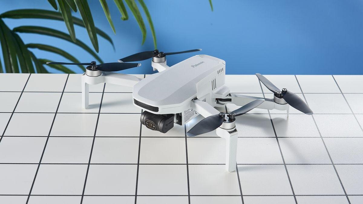
Is the?Potensic Atom?a Good First Drone? A New Pilot?s Honest Guide
Choosing your first drone can feel overwhelming?especially when you?re trying to balance price, features, and ease of use. The Potensic Atom (and its newer sibling, the Atom 2) has quickly become one of the most talked?about beginner drones thanks to its low cost, lightweight design, and surprisingly strong camera performance. But is it really the right choice for a brand?new pilot?
Let?s break down the real pros and cons so you can make a confident decision.
?
???Why the?Potensic Atom?Appeals to First?Time Pilots
1. It?s Lightweight and Doesn?t Require Registration (Recreational Use)
At?249g, the?Atom?and?Atom 2?fall under the FAA?s sub?250g category, meaning recreational flyers don?t need to register it. This makes it a stress?free entry point for new pilots.
2. Surprisingly High?Quality Camera for the Price
The Atom shoots?4K/30fps video?and?12MP stills, while the Atom 2 bumps up to?48MP photos?and?4K HDR video.
Reviewers consistently note that the image quality is?better than expected?for a budget drone.
This makes it a great starter drone for anyone wanting to capture travel footage, real estate shots, or hobbyist aerial photography.
3. Easy to Fly, Even for Total Beginners
Multiple reviewers highlight how simple the Atom is to control.
Stable flight
Beginner?friendly app
QuickShot modes for automated cinematic moves
Compact and portable design
Tom?s Guide even calls it ?a fantastic entry?level drone? very easy to fly.?
4. Excellent Value Compared to DJI
The Atom sits between the DJI Mini 2 SE and Mini 3 in terms of features?but at a much lower price point. TechRadar notes that it offers performance ?more commonly associated with pricier models.?
For new pilots who don?t want to spend $500?$800 on their first drone, this is a major win.
?
???Where the?Potensic Atom?Falls Short for New Pilots
No drone is perfect?especially at this price point. Here are the drawbacks you should know before buying.
1. No Obstacle Avoidance
This is the biggest downside for beginners.
No forward, backward, or downward sensors
You must rely entirely on your own awareness
Both TechRadar and Tom?s Guide list this as a major con.
If you?re nervous about crashing, this is something to consider.
2. Build Quality Is ?Just Passable?
Reviewers mention that the drone feels less durable than DJI models.
Not flimsy, but not rugged
Not ideal for flying in windy or rough conditions
Tom?s Guide specifically calls out the build quality as ?only just passable.?
3. Limited Ecosystem and Software Support
If you plan to grow into commercial flying, the Atom may hold you back.
No integration with AirData or professional logging tools
Fewer accessories and third?party add?ons
Less robust customer support compared to DJI
The Drone Girl review notes that commercial pilots should skip it for this reason.
4. Narrow Field of View (FOV)
The Atom?s camera has a narrower FOV than many competitors, which can make footage feel less cinematic.
5. No Collision Avoidance + Fixed Focus (Original Atom)
The original Atom uses a fixed?focus lens, which means:
Close subjects look sharper
Distant subjects may appear softer
TechRadar highlights this as a limitation.
?
???Quick Comparison: Potensic Atom vs. Atom 2 for Beginners
Feature
Weight
249g
249g
Photo Resolution
12MP
48MP
Video
4K/30fps
4K/30fps HDR
Flight Time
~25 min
25?27 min
Obstacle Avoidance
None
None
Price Range
$129?$276
$300?$520
Best For
Budget beginners
Beginners wanting better camera quality
?
?
???Should a New Pilot Buy the?Potensic Atom?
YES - if you want:
An affordable, easy?to?fly first drone
Good 4K video without spending DJI money
A lightweight drone that avoids FAA registration
A simple, beginner?friendly flying experience
NO - if you want:
Obstacle avoidance for safer flying
Professional?grade reliability
A drone for commercial work
The durability and ecosystem of DJI
?
???Final Verdict
The?Potensic Atom?is?one of the best beginner drones available today?for anyone who wants to learn to fly without a big financial commitment. It delivers impressive camera quality, stable flight, and excellent value. However, new pilots who want the safest possible flying experience?or who plan to grow into commercial drone work?may outgrow it quickly.
If you?re a brand?new recreational pilot looking for your first drone, the?Potensic Atom?is absolutely worth considering.
-
Drone Mapper
A blog by Drone_Mapper in Drone Mapping & Surveying- 1 Entry
- 0 Comments
- 1114 Views
Drone Mapper is a drone mapping enthusiast sharing beginner?friendly tips, workflows, and real?world lessons from learning photogrammetry, surveying, and UAV mapping.
Drone mapping has become one of the fastest?growing and highest?paying sectors in the drone industry. As businesses across construction, agriculture, real estate, mining, and energy shift toward data?driven decision?making, the demand for accurate aerial maps and 3D models has skyrocketed. If you?ve been considering a career in drone mapping?or want to add mapping services to your existing drone business?this guide will walk you through everything you need to know.
This is a?comprehensive, SEO?optimized guide?covering certifications, equipment, software, workflows, accuracy standards, and real?world opportunities.
?
??What Is Drone Mapping? (Definition + Why It Matters)
Drone mapping is the process of capturing aerial images with a UAV and converting them into?geospatial data products?using photogrammetry or LiDAR. These outputs include:
Orthomosaic maps?(high?resolution, distortion?free top?down imagery)
3D point clouds
Digital Elevation Models (DEM, DSM, DTM)
Contour lines
Volumetric measurements?(stockpiles, cut/fill)
Vegetation indexes?(NDVI, GNDVI, VARI)
3D textured models?for planning and visualization
Drone mapping replaces expensive helicopter flights, manual surveying, and slow ground?based measurements. It delivers?faster, safer, and more accurate?data at a fraction of the cost.
?
???Why Drone Mapping Is a High?Value Career Path
Drone mapping is one of the most profitable drone services because:
Businesses already understand the value of aerial data
Mapping requires specialized skills (less competition)
Deliverables directly impact budgets, timelines, and safety
Many industries require recurring mapping (weekly, monthly, quarterly)
Average drone mapping project value:?$500?$3,500 per job depending on size, accuracy, and deliverables.
Top industries hiring drone mappers:
Industry
Why They Need Drone Mapping
Construction
Progress tracking, earthwork volumes, site planning
Agriculture
Crop health, plant stress, irrigation analysis
Mining & Aggregates
Stockpile volumes, pit mapping, safety
Real Estate Development
Land planning, 3D models, marketing
Utilities & Energy
Inspections, corridor mapping
Insurance & Roofing
Damage assessment, measurements
?
If you want a drone career with?consistent demand, mapping is the sweet spot.
?
????Step 1: Get Legally Certified (Part 107 in the U.S.)
To fly drones commercially in the United States, you must have an?FAA Part 107 Remote Pilot Certificate.
You?ll need to understand:
Airspace classifications
Weather (METARs, TAFs)
Drone regulations
Emergency procedures
Crew resource management
Radio communications
Once certified, you can legally perform mapping missions for clients.
?
????Step 2: Choose the Right Drone for Mapping
Not all drones are suitable for mapping. You need a drone with:
20MP+ camera
Mechanical shutter?(prevents rolling?shutter distortion)
Long flight time
RTK or PPK positioning?for survey?grade accuracy
Automated flight mission capability
Best Drones for Mapping in 2026
Drone
Best For
Notes
DJI Mavic 3 Enterprise (M3E)
Most users
Compact, RTK, 20MP mechanical shutter
DJI Phantom 4 RTK
Surveying
Legendary accuracy, still widely used
DJI Matrice 350 RTK
Enterprise
Supports LiDAR, multispectral, thermal
Autel EVO II Pro RTK
DJI alternative
Strong camera, good accuracy
?
If you?re starting out, the?Mavic 3 Enterprise?offers the best balance of price, portability, and accuracy.
?
????Step 3: Learn Drone Mapping Software (Flight + Processing)
Drone mapping requires two types of software:
1. Flight Planning Software
Used to automate grid missions with proper overlap.
DJI Pilot 2
DroneDeploy Flight
Pix4D Capture
Litchi Mission Hub
2. Photogrammetry Processing Software
Used to convert images into maps and 3D models.
Pix4D Mapper?? Survey?grade accuracy
DroneDeploy?? Easiest for beginners
Agisoft Metashape?? Extremely powerful
WebODM?? Free and open source
Learning how to process data is just as important as learning how to fly.
?
???Step 4: Master the Drone Mapping Workflow
A professional drone mapper follows a consistent, repeatable workflow.
1. Pre?Planning
Check airspace
Review weather
Plan flight altitude
Set front/side overlap (70?80%)
Identify obstacles
Plan ground control points (GCPs) if needed
2. Flight Execution
Fly automated grid missions
Maintain consistent altitude
Use RTK for high accuracy
Capture nadir and oblique images if needed
3. Data Processing
Import images
Align photos
Generate point cloud
Create orthomosaic
Build DEM/DSM
Clean and classify data
4. Deliverables
Depending on the client, you may deliver:
Orthomosaic TIFF
Contour lines
3D point cloud (LAS/LAZ)
DSM/DTM
Volume reports
Crop health maps
3D textured models
?
???Step 5: Understand Accuracy, GSD, RTK, and GCPs
This is where drone mapping becomes a real technical skill.
Key Concepts Every Drone Mapper Must Know
GSD (Ground Sampling Distance)?? Determines map resolution
RTK vs PPK?? Real?time vs post?processed accuracy
GCPs (Ground Control Points)?? Used for survey?grade accuracy
Overlap?? Ensures proper photogrammetry reconstruction
Coordinate systems?? EPSG codes, local grids, state plane
Accuracy reports?? RMSE, reprojection error, checkpoints
The more you understand these, the more you can charge.
?
???Step 6: Build a Portfolio and Start Getting Clients
Drone mapping clients want to see?proof of accuracy and quality.
What to Include in Your Portfolio
Sample orthomosaics
3D models
Volume reports
Before/after progress maps
NDVI crop maps
Accuracy reports
How to Stand Out
Offer fast turnaround
Provide clean, professional reports
Demonstrate accuracy with checkpoints
Use RTK or GCPs
Build a clean, modern website
?
???The Future of Drone Mapping (2026?2030)
Drone mapping is evolving rapidly. Expect to see:
AI?powered automated analysis
Real?time mapping directly from the drone
Swarm mapping missions
Higher?accuracy sensors
Digital twins integrated with BIM
Cloud?based processing with instant results
If you start now, you?re entering the industry at the perfect time.
-
Drone Guy
A blog by Drone_Guy in Drone Community- 1 Entry
- 0 Comments
- 1339 Views
Drone Guy?s Blog delivers expert tips, guides, reviews, and real?world insights for drone pilots, beginners, and professionals looking to fly smarter and stay informed.
Latest entry by Drone_Guy,
Best Places to Fly a Drone: Incredible Locations Every Drone Pilot Should Experience
Flying a drone for the first time is exciting, but once you get comfortable in the air, you quickly realize that location is everything. The right place can turn an average flight into breathtaking footage. Wide open landscapes, dramatic coastlines, mountain peaks, and colorful city skylines can make even beginner drone pilots capture amazing shots.
If you are looking for the best places to fly a drone, this guide will walk through some incredible locations that drone pilots love. These locations offer beautiful scenery, wide open flying space, and stunning aerial photography opportunities.
Before flying anywhere, always make sure you follow FAA drone regulations, check for airspace restrictions, and respect local rules and privacy laws.
National Parks and Scenic Landscapes
One of the most breathtaking places to fly a drone is near natural landscapes. Mountains, canyons, waterfalls, and forests create incredible aerial perspectives that simply cannot be captured from the ground.
While many U.S. national parks do not allow drone flights inside park boundaries, areas just outside national parks often provide similar views with legal flying access.
Great landscapes for drone flying include:
Desert cliffs and canyon landscapes
Mountain valleys and alpine lakes
Waterfalls and river systems
Coastal cliffs and ocean viewpoints
Forest clearings and wilderness areas
Drone pilots love these locations because the elevation changes and dramatic terrain create stunning cinematic footage.
Golden hour, just after sunrise or before sunset, is especially perfect for drone photography in these areas.
Beaches and Coastlines
Beaches are one of the most popular places to fly a drone, and for good reason.
From above, the ocean creates beautiful textures and patterns that look amazing in aerial footage. Waves rolling toward the shore, surfers riding swells, and long stretches of coastline all make incredible drone shots.
Popular drone beach scenes include:
Turquoise tropical water
Rocky coastal cliffs
Sand dunes and barrier islands
Piers and lighthouses
Sunrise or sunset over the ocean
Flying over the water also gives pilots large open spaces with fewer obstacles, which makes flying easier for beginners.
Just be careful with wind conditions near the coast and avoid flying near crowded beaches.
Mountains and Scenic Overlooks
Mountain locations provide some of the most dramatic drone footage possible.
Launching from a high elevation overlook allows a drone to capture huge sweeping landscapes with deep valleys and layered ridgelines stretching for miles.
Some of the best mountain drone footage comes from:
Mountain passes
Scenic highway overlooks
Alpine lakes
Snow-covered peaks
Forest ridgelines
Drone pilots often use mountains to capture cinematic shots like slow reveals, valley fly-throughs, and panoramic landscape shots.
However, weather can change quickly in mountain environments, so always monitor wind and battery levels carefully.
Open Fields and Rural Farmland
For beginner drone pilots, open rural landscapes can be perfect practice locations.
Wide fields provide plenty of safe flying space and fewer obstacles such as trees, buildings, or power lines.
From the air, farmland also creates beautiful geometric patterns that look amazing in aerial photos.
Drone pilots often capture:
Colorful crop patterns
Tractors working fields
Sunsets across open plains
Farm buildings and barns
Rolling countryside landscapes
These areas are also excellent places to practice drone maneuvers like tracking shots, orbit shots, and cinematic flyovers.
Lakes and Rivers
Water creates some of the most visually appealing aerial footage because reflections and natural curves look incredible from above.
Drone pilots love flying around:
Large lakes and reservoirs
Meandering rivers
Waterfalls and rapids
Canoe and kayak areas
Boat docks and marinas
Flying low over calm water during sunrise or sunset can create mirror-like reflections that look stunning in drone photography.
Just remember to keep a safe altitude and avoid flying too close to the water surface unless you are comfortable with your drone controls.
City Skylines and Urban Landscapes
Urban drone footage can be incredibly dramatic when done legally and safely.
City skylines, bridges, highways, and architecture all look amazing from above. However, urban flying usually requires extra caution because cities often sit inside controlled airspace.
Drone pilots should always check airspace using apps like LAANC or B4UFLY before flying in any city environment.
Some of the most visually interesting urban drone scenes include:
Downtown skylines at sunset
Bridges crossing rivers
Busy highways with light trails
Waterfront cityscapes
Stadiums and large landmarks
Urban footage often works best during sunrise or sunset when lighting conditions are softer and shadows add depth to buildings.
Hidden Local Gems
Some of the best drone flying locations are places that most people overlook.
Local parks, small lakes, abandoned structures, and quiet countryside roads can all become amazing drone footage locations.
Many experienced drone pilots spend time exploring their region looking for:
Scenic backroads
Hidden waterfalls
Old barns and historic buildings
Wildlife areas
Remote hiking trails
Sometimes my best drone footage comes from locations that are close to home but rarely seen from the air.
Tips for Finding Great Drone Flying Locations
If you want to discover new drone locations, try these simple strategies:
Search Google Maps in satellite view to identify interesting terrain and landscapes.
Look for elevation changes such as cliffs, hills, and valleys that create dramatic aerial views.
Explore state parks and public lands where drone flying is allowed.
Use drone community forums where pilots share popular flight locations.
Pay attention to sunrise and sunset lighting, which dramatically improves aerial footage.
Final Thoughts
Drones give us a completely new way to experience the world. Whether you are flying over beaches, mountains, lakes, farmland, or city skylines, the sky truly opens up incredible photography and video opportunities.
The best places to fly a drone are locations that combine beautiful scenery with safe and legal flying conditions.
With the right location, even beginner drone pilots can capture footage that looks cinematic and professional.
The most important thing is to fly responsibly, respect regulations, and always be aware of your surroundings.
Once you start exploring from the air, you will quickly realize that there are amazing drone flying locations almost everywhere.
And sometimes, the best drone footage comes from simply launching your drone and discovering a view that few people have ever seen before.
-
Drone Newbie Help
A blog by drone_newbie_help in Drone Tutorials- 0 Entries
- 0 Comments
- 160 Views
Personal drone flying experiences, equipment reviews, aerial photography projects, safety notes, and drone-related adventures.No blog entries yet
-
Kevin Brown Flies
A blog by Kevin Brown in Drone Buying Guides- 0 Entries
- 0 Comments
- 126 Views
Personal drone flying experiences, equipment reviews, aerial photography projects, safety notes, and drone-related adventures.No blog entries yet
-
Up In The Frame
A blog by Emma Wilson in Drone Racing- 0 Entries
- 0 Comments
- 192 Views
Personal drone flying experiences, equipment reviews, aerial photography projects, safety notes, and drone-related adventures.No blog entries yet
-
Low Altitude Diaries
A blog by Daniel Wright in Drone Racing- 0 Entries
- 0 Comments
- 178 Views
Personal drone flying experiences, equipment reviews, aerial photography projects, safety notes, and drone-related adventures.No blog entries yet
-
Low and Fast Aerial
A blog by racing_drone_dude in Drone Racing- 0 Entries
- 0 Comments
- 206 Views
Personal drone flying experiences, equipment reviews, aerial photography projects, safety notes, and drone-related adventures.No blog entries yet